NAVIGATION
|
HOME
• FLAG FINDER
• MAP FINDER
• SOURCES
• ADD YOURSELF TO THE ATLAS! COUNTRIES A-D • COUNTRIES E-K • COUNTRIES L-R • COUNTRIES S-Z |
NAVIGATION
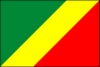
Republic of the Congo
Republique du Congo
former: Middle Congo, Congo/Brazzaville, Congo


INTRODUCTION
|
Background:
|
Upon independence in 1960, the former French region of Middle Congo became the Republic of the Congo. A quarter century of experimentation with Marxism was abandoned in 1990 and a democratically elected government installed in 1992. A brief civil war in 1997 restored former Marxist President SASSOU-NGUESSO. |
GEOGRAPHY
|
Location:
|
Western Africa, bordering the South Atlantic Ocean, between Angola and Gabon |
|
Geographic coordinates:
|
1 00 S, 15 00 E |
|
Map references:
|
Africa |
|
Area:
|
total: 342,000 sq km
water: 500 sq km land: 341,500 sq km |
|
Area - comparative:
|
slightly smaller than Montana |
|
Land boundaries:
|
total: 5,504 km
border countries: Angola 201 km, Cameroon 523 km, Central African Republic 467 km, Democratic Republic of the Congo 2,410 km, Gabon 1,903 km |
|
Coastline:
|
169 km |
|
Maritime claims:
|
territorial sea: 200 NM |
|
Climate:
|
tropical; rainy season (March to June); dry season (June to October); constantly high temperatures and humidity; particularly enervating climate astride the Equator |
|
Terrain:
|
coastal plain, southern basin, central plateau, northern basin |
|
Elevation extremes:
|
lowest point: Atlantic Ocean 0 m
highest point: Mount Berongou 903 m |
|
Natural resources:
|
petroleum, timber, potash, lead, zinc, uranium, copper, phosphates, natural gas, hydropower |
|
Land use:
|
arable land: 0.5%
permanent crops: 0.13% other: 99.37% (1998 est.) |
|
Irrigated land:
|
10 sq km (1998 est.) |
|
Natural hazards:
|
seasonal flooding |
|
Environment - current issues:
|
air pollution from vehicle emissions; water pollution from the dumping of raw sewage; tap water is not potable; deforestation |
|
Environment - international agreements:
|
party to: Biodiversity, Climate Change, Desertification, Endangered Species, Ozone Layer Protection, Tropical Timber 83, Tropical Timber 94, Wetlands
signed, but not ratified: Law of the Sea |
|
Geography - note:
|
about 70% of the population lives in Brazzaville, Pointe-Noire, or along the railroad between them |
PEOPLE
|
Population:
|
2,958,448
note: estimates for this country explicitly take into account the effects of excess mortality due to AIDS; this can result in lower life expectancy, higher infant mortality and death rates, lower population and growth rates, and changes in the distribution of population by age and sex than would otherwise be expected (July 2002 est.) |
|
Age structure:
|
0-14 years: 42.4% (male 630,985; female 622,024)
15-64 years: 54.3% (male 783,238; female 823,882) 65 years and over: 3.3% (male 39,369; female 58,950) (2002 est.) |
|
Population growth rate:
|
2.18% (2002 est.) |
|
Birth rate:
|
37.91 births/1,000 population (2002 est.) |
|
Death rate:
|
16.1 deaths/1,000 population (2002 est.) |
|
Net migration rate:
|
0 migrant(s)/1,000 population (2002 est.) |
|
Sex ratio:
|
at birth: 1.03 male(s)/female
under 15 years: 1.01 male(s)/female 15-64 years: 0.95 male(s)/female 65 years and over: 0.67 male(s)/female total population: 0.97 male(s)/female (2002 est.) |
|
Infant mortality rate:
|
97.91 deaths/1,000 live births (2002 est.) |
|
Life expectancy at birth:
|
total population: 47.71 years
female: 51.24 years (2002 est.) male: 44.27 years |
|
Total fertility rate:
|
4.94 children born/woman (2002 est.) |
|
HIV/AIDS - adult prevalence rate:
|
6.43% (1999 est.) |
|
HIV/AIDS - people living with HIV/AIDS:
|
86,000 (1999 est.) |
|
HIV/AIDS - deaths:
|
8,600 (1999 est.) |
|
Nationality:
|
noun: Congolese (singular and plural)
adjective: Congolese or Congo |
|
Ethnic groups:
|
Kongo 48%, Sangha 20%, M'Bochi 12%, Teke 17%, Europeans and other 3%
note: Europeans estimated at 8,500, mostly French, before the 1997 civil war; may be half that in 1998, following the widespread destruction of foreign businesses in 1997 |
|
Religions:
|
Christian 50%, animist 48%, Muslim 2% |
|
Languages:
|
French (official), Lingala and Monokutuba (lingua franca trade languages), many local languages and dialects (of which Kikongo has the most users) |
|
Literacy:
|
definition: age 15 and over can read and write
total population: 74.9% male: 83.1% female: 67.2% (1995 est.) |