NAVIGATION
|
HOME
• FLAG FINDER
• MAP FINDER
• SOURCES
• ADD YOURSELF TO THE ATLAS! COUNTRIES A-D • COUNTRIES E-K • COUNTRIES L-R • COUNTRIES S-Z |
NAVIGATION
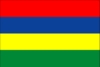
Republic of Mauritius


INTRODUCTION
|
Background:
|
Discovered by the Portuguese in 1505, Mauritius was subsequently held by the Dutch, French, and British before independence was attained in 1968. A stable democracy with regular free elections and a positive human rights record, the country has attracted considerable foreign investment and has earned one of Africa's highest per capita incomes. Recent poor weather and declining sugar prices have slowed economic growth leading to some protests over standards of living in the Creole community. |
GEOGRAPHY
|
Location:
|
Southern Africa, island in the Indian Ocean, east of Madagascar |
|
Geographic coordinates:
|
20 17 S, 57 33 E |
|
Map references:
|
Political Map of the World |
|
Area:
|
total: 2,040 sq km
note: includes Agalega Islands, Cargados Carajos Shoals (Saint Brandon), and Rodrigues water: 10 sq km land: 2,030 sq km |
|
Area - comparative:
|
almost 11 times the size of Washington, DC |
|
Land boundaries:
|
0 km |
|
Coastline:
|
177 km |
|
Maritime claims:
|
continental shelf: 200 NM or to the edge of the continental margin
territorial sea: 12 NM exclusive economic zone: 200 NM |
|
Climate:
|
tropical, modified by southeast trade winds; warm, dry winter (May to November); hot, wet, humid summer (November to May) |
|
Terrain:
|
small coastal plain rising to discontinuous mountains encircling central plateau |
|
Elevation extremes:
|
lowest point: Indian Ocean 0 m
highest point: Mont Piton 828 m |
|
Natural resources:
|
arable land, fish |
|
Land use:
|
arable land: 49.26%
permanent crops: 2.96% other: 47.78% (1998 est.) |
|
Irrigated land:
|
200 sq km (1998 est.) |
|
Natural hazards:
|
cyclones (November to April); almost completely surrounded by reefs that may pose maritime hazards |
|
Environment - current issues:
|
water pollution, degradation of coral reefs |
|
Environment - international agreements:
|
party to: Biodiversity, Climate Change, Climate Change-Kyoto Protocol, Desertification, Endangered Species, Environmental Modification, Hazardous Wastes, Law of the Sea, Marine Life Conservation, Nuclear Test Ban, Ozone Layer Protection, Ship Pollution, Wetlands
signed, but not ratified: none of the selected agreements |
|
Geography - note:
|
the main island, from which the country derives its name, is of volcanic origin and is almost entirely surrounded by coral reefs |
PEOPLE
|
Population:
|
1,200,206 (July 2002 est.) |
|
Age structure:
|
0-14 years: 25.4% (male 153,810; female 150,464)
15-64 years: 68.3% (male 409,028; female 411,070) 65 years and over: 6.3% (male 30,170; female 45,664) (2002 est.) |
|
Population growth rate:
|
0.86% (2002 est.) |
|
Birth rate:
|
16.34 births/1,000 population (2002 est.) |
|
Death rate:
|
6.81 deaths/1,000 population (2002 est.) |
|
Net migration rate:
|
-0.92 migrant(s)/1,000 population (2002 est.) |
|
Sex ratio:
|
at birth: 1.02 male(s)/female
under 15 years: 1.02 male(s)/female 15-64 years: 1 male(s)/female 65 years and over: 0.66 male(s)/female total population: 0.98 male(s)/female (2002 est.) |
|
Infant mortality rate:
|
16.65 deaths/1,000 live births (2002 est.) |
|
Life expectancy at birth:
|
total population: 71.53 years
female: 75.58 years (2002 est.) male: 67.54 years |
|
Total fertility rate:
|
2 children born/woman (2002 est.) |
|
HIV/AIDS - adult prevalence rate:
|
0.08% (1999 est.) |
|
HIV/AIDS - people living with HIV/AIDS:
|
NA |
|
HIV/AIDS - deaths:
|
NA |
|
Nationality:
|
noun: Mauritian(s)
adjective: Mauritian |
|
Ethnic groups:
|
Indo-Mauritian 68%, Creole 27%, Sino-Mauritian 3%, Franco-Mauritian 2% |
|
Religions:
|
Hindu 52%, Christian 28.3% (Roman Catholic 26%, Protestant 2.3%), Muslim 16.6%, other 3.1% |
|
Languages:
|
English (official), Creole, French (official), Hindi, Urdu, Hakka, Bhojpuri |
|
Literacy:
|
definition: age 15 and over can read and write
total population: 82.9% male: 87.1% female: 78.8% (1995 est.) |